
Thank you for supporting this site ❤️
Make a donation
Make a donation
Gear up for your next adventure:
As an Amazon Associate, this site earns from qualifying purchases at no extra cost to you.
Janca topographic map
Click on the map to display elevation.
Thank you for supporting this site ❤️
Make a donation
Make a donation
Gear up for your next adventure:
As an Amazon Associate, this site earns from qualifying purchases at no extra cost to you.
About this map
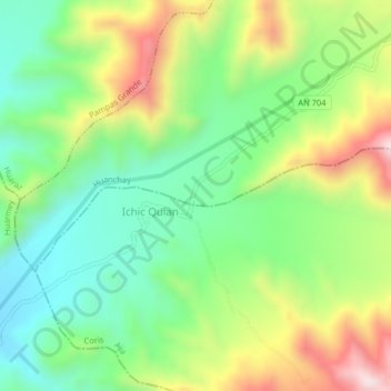
Name: Janca topographic map, elevation, terrain.
Location: Janca, Huanchay, Provincia de Huaraz, Áncash, Perú (-9.79249 -77.96473 -9.75249 -77.92473)
Average elevation: 2,953 ft
Minimum elevation: 2,172 ft
Maximum elevation: 4,236 ft
Thank you for supporting this site ❤️
Make a donation
Make a donation
Gear up for your next adventure:
As an Amazon Associate, this site earns from qualifying purchases at no extra cost to you.