Geolocate

Earby topographic map

Click on the map to display elevation.

About this map

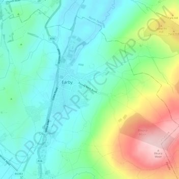
Name: Earby topographic map, elevation, terrain.

Location: Earby, Borough of Pendle, Lancashire, England, United Kingdom (53.89980 -2.16352 53.92947 -2.10746)

Average elevation: 646 ft

Minimum elevation: 410 ft

Maximum elevation: 1,194 ft

Gear up for your next adventure:

🕶️GPS Smartphone Mount - Secure mount for phone navigation
🎒Waterproof Dry Bags - Keep your electronics and maps dry inside your pack
🪶LED Camping Lantern - Bright lantern for camp lighting
🥩Freeze-Dried Meals - Nutritious and lightweight food for remote expeditions
🔥Fast-Boil Camping Stoves - Efficient cooking systems for quick trail meals

As an Amazon Associate, this site earns from qualifying purchases at no extra cost to you.