
Thank you for supporting this site ❤️
Make a donation
Make a donation
Gear up for your next adventure:
As an Amazon Associate, this site earns from qualifying purchases at no extra cost to you.
Bignona topographic map
Click on the map to display elevation.
Thank you for supporting this site ❤️
Make a donation
Make a donation
Gear up for your next adventure:
As an Amazon Associate, this site earns from qualifying purchases at no extra cost to you.
About this map
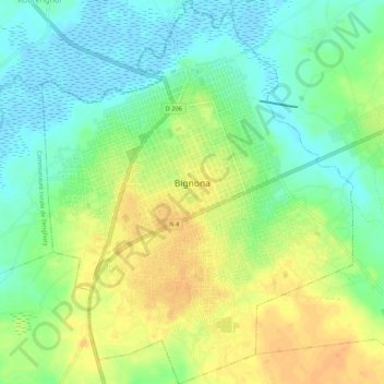
Name: Bignona topographic map, elevation, terrain.
Location: Bignona, Département de Bignona, Ziguinchor Region, Senegal (12.77365 -16.25005 12.82610 -16.20639)
Average elevation: 56 ft
Minimum elevation: -10 ft
Maximum elevation: 118 ft
Thank you for supporting this site ❤️
Make a donation
Make a donation
Gear up for your next adventure:
As an Amazon Associate, this site earns from qualifying purchases at no extra cost to you.