Geolocate

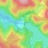
Balga topographic map

Click on the map to display elevation.

About this map

Name: Balga topographic map, elevation, terrain.

Location: Balga, Perth, Western Australia, 6061, Australia (-31.86511 115.82322 -31.84202 115.85525)

Average elevation: 180 ft

Minimum elevation: 89 ft

Maximum elevation: 262 ft

Other topographic maps

Click on a map to view its topography, its elevation and its terrain.
Lake Claremont

Australia > Western Australia > Perth

Average elevation: 72 ft

Canning river

Australia > Western Australia > Perth

Average elevation: 961 ft

Reabold Hill

Australia > Western Australia > Perth

Average elevation: 105 ft

Mundaring Weir

Australia > Western Australia > Perth

Average elevation: 607 ft

Adenia Lagoon

Australia > Western Australia > Perth

Average elevation: 30 ft

Lake Gwelup

Australia > Western Australia > Perth

Average elevation: 82 ft

Mosman Beach

Australia > Western Australia > Perth

Average elevation: 30 ft

Woodford Park

Australia > Western Australia > Perth

Average elevation: 36 ft

Hatfield Park

Australia > Western Australia > Perth

Average elevation: 79 ft

Brittania Reserve

Australia > Western Australia > Perth

Average elevation: 82 ft

Alderley Park

Australia > Western Australia > Perth

Average elevation: 33 ft

Bold Park

Australia > Western Australia > Perth

Average elevation: 112 ft

Gear up for your next adventure:

🗃️Trail First Aid Kit - Essential kit for outdoor injuries and emergencies
🍳Camping Cook Set - Complete cookware for outdoor meals
🛡️Bear Spray Outdoor - Protection in bear country hikes
⛺Backpacking Tents - Weight-optimized shelters for multi-day topographic surveys
🔭Compact Binoculars - HD vision for scouting terrain and identifying distant landmarks

As an Amazon Associate, this site earns from qualifying purchases at no extra cost to you.