Geolocate

Cougar topographic map

Click on the map to display elevation.

About this map

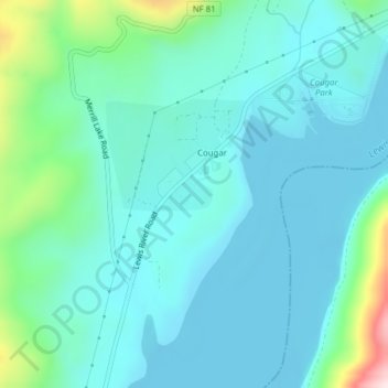
Name: Cougar topographic map, elevation, terrain.

Location: Cougar, Cowlitz County, Washington, United States (46.03794 -122.31177 46.05878 -122.29197)

Average elevation: 705 ft

Minimum elevation: 463 ft

Maximum elevation: 1,844 ft

Cowlitz County trails, hiking, mountain biking, running and outdoor activities

Gear up for your next adventure:

🩳Quick‑Dry Hiking Shorts - Comfortable and quick‑dry shorts for summer hiking
🦟Ultrasonic Repellers - Create a bug-free zone at your camp or rest stop
🧷Carabiner Set - Durable clips for gear attachment
📷Action Camera - Capture your outdoor adventures in HD
👟Trail Running Shoes - Lightweight shoes for trail runners

As an Amazon Associate, this site earns from qualifying purchases at no extra cost to you.