
Make a donation
Gear up for your next adventure:
As an Amazon Associate, this site earns from qualifying purchases at no extra cost to you.
Aït R'Zine topographic map
Click on the map to display elevation.
Make a donation
Gear up for your next adventure:
As an Amazon Associate, this site earns from qualifying purchases at no extra cost to you.
About this map
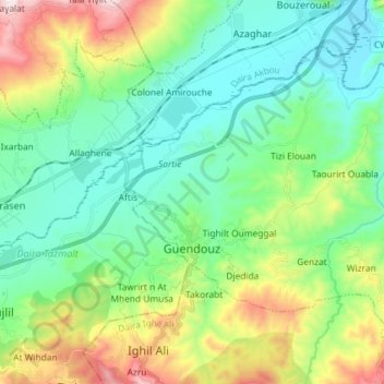
Name: Aït R'Zine topographic map, elevation, terrain.
Location: Aït R'Zine, Daïra Ighil Ali, Béjaïa, 06013, Algérie (36.34161 4.46111 36.43030 4.60614)
Average elevation: 1,302 ft
Minimum elevation: 522 ft
Maximum elevation: 3,301 ft
Make a donation
Gear up for your next adventure:
As an Amazon Associate, this site earns from qualifying purchases at no extra cost to you.
Other topographic maps
Click on a map to view its topography, its elevation and its terrain.
Kalâa des Beni Abbès
Algérie > Béjaïa > Daïra Ighil Ali > Ighil Ali
La Kalâa, épousant le relief (en forme de cœur) est bâtie sur un plateau rocheux d'une superficie de 400 hectares dans la chaîne des Bibans, à près de 1 000 mètres d'altitude.
Average elevation: 2,717 ft
Ighil el Djamaâ
Algérie > Béjaïa > Daïra Ighil Ali > Ighil Ali > Kalâa des Beni Abbès
Average elevation: 2,566 ft
Make a donation
Gear up for your next adventure:
As an Amazon Associate, this site earns from qualifying purchases at no extra cost to you.