
Thank you for supporting this site ❤️
Make a donation
Make a donation
Gear up for your next adventure:
As an Amazon Associate, this site earns from qualifying purchases at no extra cost to you.
Thalheim topographic map
Click on the map to display elevation.
Thank you for supporting this site ❤️
Make a donation
Make a donation
Gear up for your next adventure:
As an Amazon Associate, this site earns from qualifying purchases at no extra cost to you.
About this map
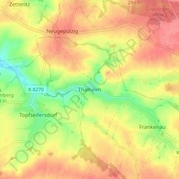
Name: Thalheim topographic map, elevation, terrain.
Location: Thalheim, Mittweida, Mittelsachsen, Sachsen, Deutschland (50.98201 12.86603 51.02201 12.90603)
Average elevation: 902 ft
Minimum elevation: 768 ft
Maximum elevation: 994 ft
Thank you for supporting this site ❤️
Make a donation
Make a donation
Gear up for your next adventure:
As an Amazon Associate, this site earns from qualifying purchases at no extra cost to you.