
Serra do Açor Protected Landscape topographic map
Interactive map
Click on the map to display elevation.
About this map
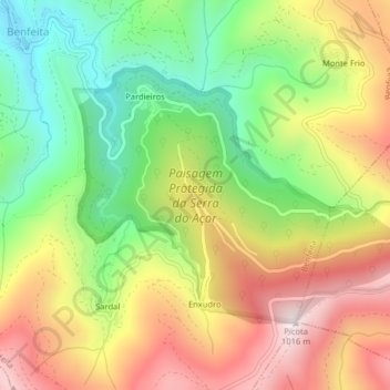
Name: Serra do Açor Protected Landscape topographic map, elevation, terrain.
Average elevation: 2,060 ft
Minimum elevation: 961 ft
Maximum elevation: 3,291 ft
Other topographic maps
Click on a map to view its topography, its elevation and its terrain.