
Thank you for supporting this site ❤️
Make a donation
Make a donation
Gear up for your next adventure:
As an Amazon Associate, this site earns from qualifying purchases at no extra cost to you.
Ampato topographic map
Click on the map to display elevation.
Thank you for supporting this site ❤️
Make a donation
Make a donation
Gear up for your next adventure:
As an Amazon Associate, this site earns from qualifying purchases at no extra cost to you.
About this map
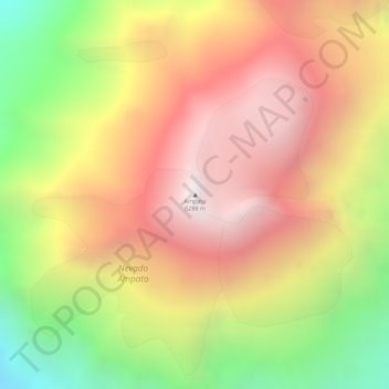
Name: Ampato topographic map, elevation, terrain.
Location: Ampato, Lluta, Caylloma, Arequipa, Peru (-15.82055 -71.88022 -15.82045 -71.88012)
Average elevation: 18,976 ft
Minimum elevation: 16,683 ft
Maximum elevation: 20,617 ft
Thank you for supporting this site ❤️
Make a donation
Make a donation
Gear up for your next adventure:
As an Amazon Associate, this site earns from qualifying purchases at no extra cost to you.