
Make a donation
Gear up for your next adventure:
As an Amazon Associate, this site earns from qualifying purchases at no extra cost to you.
Dertingen topographic map
Click on the map to display elevation.
Make a donation
Gear up for your next adventure:
As an Amazon Associate, this site earns from qualifying purchases at no extra cost to you.
Dertingen
Ortschaften: Bettingen | Dertingen | Dietenhan | Dörlesberg | Grünenwört | Höhefeld | Kembach | Lindelbach | Mondfeld | Nassig | Reicholzheim mit Bronnbach | Sachsenhausen | Sonderriet | Urphar | Waldenhausen |
Make a donation
Gear up for your next adventure:
As an Amazon Associate, this site earns from qualifying purchases at no extra cost to you.
About this map
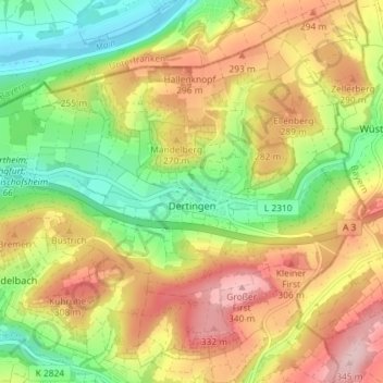
Name: Dertingen topographic map, elevation, terrain.
Average elevation: 787 ft
Minimum elevation: 459 ft
Maximum elevation: 1,145 ft
Make a donation
Gear up for your next adventure:
As an Amazon Associate, this site earns from qualifying purchases at no extra cost to you.
Other topographic maps
Click on a map to view its topography, its elevation and its terrain.
Make a donation
Gear up for your next adventure:
As an Amazon Associate, this site earns from qualifying purchases at no extra cost to you.
Bronnbach
Deutschland > Baden-Württemberg > Main-Tauber-Kreis > Wertheim
Nach dem Willen der Stadt Külsheim wurde von 1895 an versucht, mittels einer Petition beim Badischen Landtag eine Bahnlinie von Walldürn über Hardheim, Schweinberg, Külsheim und Bronnbach nach Wertheim zu führen, um den Absatz landwirtschaftlicher Erzeugnisse zu verbessern. Eine Verbindung über…
Average elevation: 797 ft