Geolocate

Redland topographic map

Click on the map to display elevation.

About this map

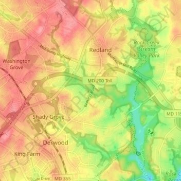
Name: Redland topographic map, elevation, terrain.

Location: Redland, Montgomery County, Maryland, 20855, United States (39.10600 -77.17777 39.15938 -77.11515)

Average elevation: 446 ft

Minimum elevation: 285 ft

Maximum elevation: 554 ft

Montgomery County trails, hiking, mountain biking, running and outdoor activities

Gear up for your next adventure:

🪶Trail Camera - Capture wildlife on your hikes
🥾Men's Hiking Boots - Durable, waterproof footwear for rugged terrain and steep inclines
🩳Quick‑Dry Hiking Shorts - Comfortable and quick‑dry shorts for summer hiking
🧭Orienteering Set - Complete compass and map reading kit
🌎3D Topographic Globes - Raised relief globes for a tactile understanding of geography

As an Amazon Associate, this site earns from qualifying purchases at no extra cost to you.