
Thank you for supporting this site ❤️
Make a donation
Make a donation
Gear up for your next adventure:
As an Amazon Associate, this site earns from qualifying purchases at no extra cost to you.
Vincy topographic map
Click on the map to display elevation.
Thank you for supporting this site ❤️
Make a donation
Make a donation
Gear up for your next adventure:
As an Amazon Associate, this site earns from qualifying purchases at no extra cost to you.
About this map
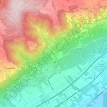
Name: Vincy topographic map, elevation, terrain.
Location: Vincy, Gilly, District de Nyon, Vaud, 1182, Suisse (46.44339 6.28116 46.48339 6.32116)
Average elevation: 1,959 ft
Minimum elevation: 1,214 ft
Maximum elevation: 2,972 ft
Thank you for supporting this site ❤️
Make a donation
Make a donation
Gear up for your next adventure:
As an Amazon Associate, this site earns from qualifying purchases at no extra cost to you.