Geolocate

Taal topographic map

Click on the map to display elevation.

About this map

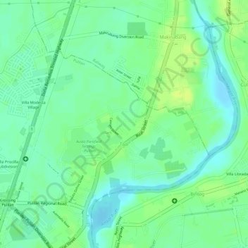
Name: Taal topographic map, elevation, terrain.

Location: Taal, Pulilan, Bulacan, Central Luzon, Philippines (14.90193 120.86901 14.91862 120.89039)

Average elevation: 39 ft

Minimum elevation: 10 ft

Maximum elevation: 62 ft

Other topographic maps

Click on a map to view its topography, its elevation and its terrain.

Dulong Malabon

Philippines > Bulacan > Pulilan

Average elevation: 20 ft

Gear up for your next adventure:

🪶Paracord Bracelet - Survival bracelet with built‑in tools
🪑Ultralight Camp Chairs - Portable seating for resting after a long day of mapping
🏕️Tent Footprint - Protect your tent base from wear
🔭Telescopic Hiking Pole - Adjustable pole for hiking stability
🎒Outdoor Daypacks - Lightweight backpacks designed for carrying maps and essential gear

As an Amazon Associate, this site earns from qualifying purchases at no extra cost to you.