Geolocate

Stepanakert topographic map

Click on the map to display elevation.

About this map

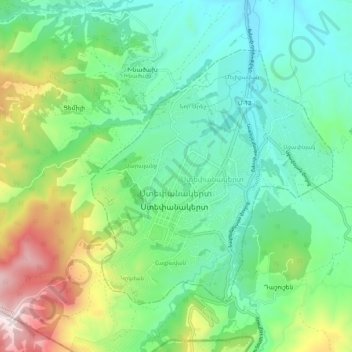
Name: Stepanakert topographic map, elevation, terrain.

Location: Stepanakert, Ստեփանակերտ, Khojaly Region, Azerbaijan (39.77820 46.71172 39.85820 46.79172)

Average elevation: 3,041 ft

Minimum elevation: 2,093 ft

Maximum elevation: 5,144 ft

Gear up for your next adventure:

🥘Titanium Cookware - Durable, featherlight pots and pans for backpacking
🛡️Insect Repellent - Protection against bugs during outdoor activities
🪓Survival Multi‑Tool - Versatile tool for camp and trail tasks
🧢Sun Protection Hats - Wide-brimmed and UPF-rated hats for high-altitude sun safety
🧷Carabiner Set - Durable clips for gear attachment

As an Amazon Associate, this site earns from qualifying purchases at no extra cost to you.