
Thank you for supporting this site ❤️
Make a donation
Make a donation
Gear up for your next adventure:
As an Amazon Associate, this site earns from qualifying purchases at no extra cost to you.
Whitehouse topographic map
Click on the map to display elevation.
Thank you for supporting this site ❤️
Make a donation
Make a donation
Gear up for your next adventure:
As an Amazon Associate, this site earns from qualifying purchases at no extra cost to you.
About this map
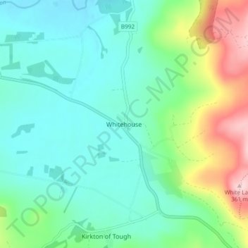
Name: Whitehouse topographic map, elevation, terrain.
Location: Whitehouse, Aberdeenshire, Scotland, AB33 8DJ, United Kingdom (57.20442 -2.65354 57.24442 -2.61354)
Average elevation: 594 ft
Minimum elevation: 390 ft
Maximum elevation: 1,188 ft
Thank you for supporting this site ❤️
Make a donation
Make a donation
Gear up for your next adventure:
As an Amazon Associate, this site earns from qualifying purchases at no extra cost to you.