
Raab topographic map
Click on the map to display elevation.
About this map
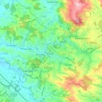
Name: Raab topographic map, elevation, terrain.
Location: Raab, Bezirk Schärding, Upper Austria, 4760, Austria (48.33177 13.60015 48.37718 13.70570)
Average elevation: 1,348 ft
Minimum elevation: 1,138 ft
Maximum elevation: 1,788 ft