
Thank you for supporting this site ❤️
Make a donation
Make a donation
Gear up for your next adventure:
As an Amazon Associate, this site earns from qualifying purchases at no extra cost to you.
Guilhafonso topographic map
Click on the map to display elevation.
Thank you for supporting this site ❤️
Make a donation
Make a donation
Gear up for your next adventure:
As an Amazon Associate, this site earns from qualifying purchases at no extra cost to you.
About this map
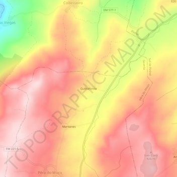
Name: Guilhafonso topographic map, elevation, terrain.
Location: Guilhafonso, Guarda, Portugal (40.61211 -7.22002 40.65211 -7.18002)
Average elevation: 2,703 ft
Minimum elevation: 2,001 ft
Maximum elevation: 3,061 ft
Thank you for supporting this site ❤️
Make a donation
Make a donation
Gear up for your next adventure:
As an Amazon Associate, this site earns from qualifying purchases at no extra cost to you.