
Thank you for supporting this site ❤️
Make a donation
Make a donation
Gear up for your next adventure:
As an Amazon Associate, this site earns from qualifying purchases at no extra cost to you.
Saryagash topographic map
Click on the map to display elevation.
Thank you for supporting this site ❤️
Make a donation
Make a donation
Gear up for your next adventure:
As an Amazon Associate, this site earns from qualifying purchases at no extra cost to you.
About this map
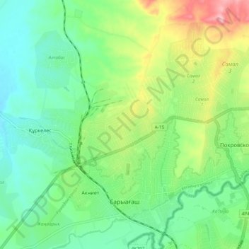
Name: Saryagash topographic map, elevation, terrain.
Location: Saryagash, Saryagash District, Turkistan Region, Kazakhstan (41.43684 69.14429 41.50646 69.22283)
Average elevation: 1,427 ft
Minimum elevation: 1,257 ft
Maximum elevation: 1,791 ft
Thank you for supporting this site ❤️
Make a donation
Make a donation
Gear up for your next adventure:
As an Amazon Associate, this site earns from qualifying purchases at no extra cost to you.