
Thank you for supporting this site ❤️
Make a donation
Make a donation
Gear up for your next adventure:
As an Amazon Associate, this site earns from qualifying purchases at no extra cost to you.
Aurín topographic map
Click on the map to display elevation.
Thank you for supporting this site ❤️
Make a donation
Make a donation
Gear up for your next adventure:
As an Amazon Associate, this site earns from qualifying purchases at no extra cost to you.
About this map
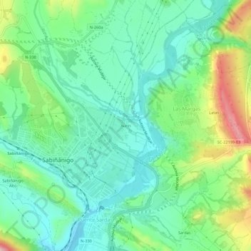
Name: Aurín topographic map, elevation, terrain.
Location: Aurín, Sabiñánigo, Alto Gállego, Huesca, Aragón, 22613, España (42.50381 -0.37012 42.54381 -0.33012)
Average elevation: 2,697 ft
Minimum elevation: 2,464 ft
Maximum elevation: 3,258 ft
Thank you for supporting this site ❤️
Make a donation
Make a donation
Gear up for your next adventure:
As an Amazon Associate, this site earns from qualifying purchases at no extra cost to you.