
Brody Urban Hromada topographic map
Interactive map
Click on the map to display elevation.
About this map
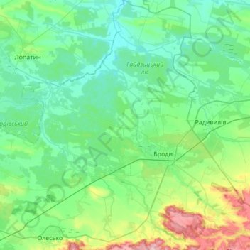
Name: Brody Urban Hromada topographic map, elevation, terrain.
Location: Brody Urban Hromada, Zolochiv Raion, Lviv Oblast, Ukraine (49.94739 24.83057 50.30056 25.33183)
Average elevation: 761 ft
Minimum elevation: 623 ft
Maximum elevation: 1,401 ft
Other topographic maps
Click on a map to view its topography, its elevation and its terrain.