
Thank you for supporting this site ❤️
Make a donation
Make a donation
Gear up for your next adventure:
As an Amazon Associate, this site earns from qualifying purchases at no extra cost to you.
Nandipur topographic map
Click on the map to display elevation.
Thank you for supporting this site ❤️
Make a donation
Make a donation
Gear up for your next adventure:
As an Amazon Associate, this site earns from qualifying purchases at no extra cost to you.
About this map
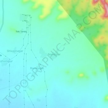
Name: Nandipur topographic map, elevation, terrain.
Location: Nandipur, Pusad, Yavatmal, Maharashtra, 445204, India (19.94529 77.58363 19.98529 77.62363)
Average elevation: 1,240 ft
Minimum elevation: 1,122 ft
Maximum elevation: 1,742 ft
Thank you for supporting this site ❤️
Make a donation
Make a donation
Gear up for your next adventure:
As an Amazon Associate, this site earns from qualifying purchases at no extra cost to you.