
Chihani topographic map
Interactive map
Click on the map to display elevation.
About this map
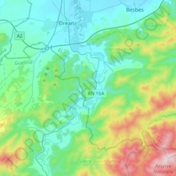
Name: Chihani topographic map, elevation, terrain.
Location: Chihani, Daïra Drean, El Tarf, Algérie (36.53013 7.72045 36.68941 7.97369)
Average elevation: 715 ft
Minimum elevation: 39 ft
Maximum elevation: 2,953 ft
Other topographic maps
Click on a map to view its topography, its elevation and its terrain.
Drean
Algérie > El Tarf > Daïra Drean
Drean, Daïra Drean, El Tarf, 36200, Algérie
Average elevation: 125 ft