
广阳区 topographic map
Interactive map
Click on the map to display elevation.
About this map
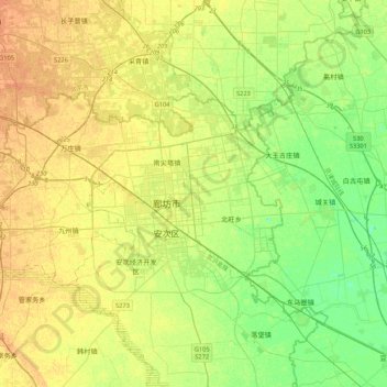
Name: 广阳区 topographic map, elevation, terrain.
Location: 广阳区, 廊坊市, 河北省, 102802, 中国 (39.45197 116.39521 39.62377 116.82034)
Average elevation: 52 ft
Minimum elevation: 3 ft
Maximum elevation: 98 ft
Other topographic maps
Click on a map to view its topography, its elevation and its terrain.