Geolocate

Banglor topographic map

Click on the map to display elevation.

About this map

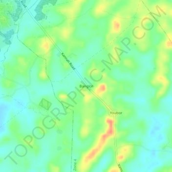
Name: Banglor topographic map, elevation, terrain.

Location: Banglor, Zone 4, Tchien, Grand Gedeh County, Liberia (6.02653 -8.12935 6.06653 -8.08935)

Average elevation: 686 ft

Minimum elevation: 633 ft

Maximum elevation: 774 ft

Gear up for your next adventure:

🩹Survival Bandages - High‑quality bandages for emergencies
🔥Plasma Lighters - Windproof lighters that work in any weather condition
🎁Geography Themed Gifts - Unique gift ideas for map lovers and geography enthusiasts
🌡️Portable Weather Meter - Track weather conditions on the trail
📡GPS Antenna Upgrade - Enhance GPS reception in remote terrain

As an Amazon Associate, this site earns from qualifying purchases at no extra cost to you.