
Make a donation
Gear up for your next adventure:
As an Amazon Associate, this site earns from qualifying purchases at no extra cost to you.
Haslach topographic map
Click on the map to display elevation.
Make a donation
Gear up for your next adventure:
As an Amazon Associate, this site earns from qualifying purchases at no extra cost to you.
About this map
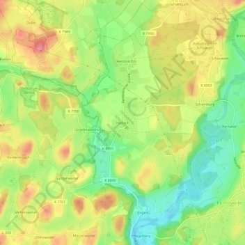
Name: Haslach topographic map, elevation, terrain.
Average elevation: 1,791 ft
Minimum elevation: 1,621 ft
Maximum elevation: 1,972 ft
Make a donation
Gear up for your next adventure:
As an Amazon Associate, this site earns from qualifying purchases at no extra cost to you.
Other topographic maps
Click on a map to view its topography, its elevation and its terrain.
88239
Deutschland > Baden-Württemberg > Landkreis Ravensburg > Wangen im Allgäu
Average elevation: 2,011 ft
Neuravensburg
Deutschland > Baden-Württemberg > Landkreis Ravensburg > Wangen im Allgäu
Average elevation: 1,755 ft
Deuchelried
Deutschland > Baden-Württemberg > Landkreis Ravensburg > Wangen im Allgäu
Average elevation: 2,005 ft
Burgruine Neuravensburg
Deutschland > Baden-Württemberg > Landkreis Ravensburg > Wangen im Allgäu > Neuravensburg > Föhlschmitten
Die Burgruine Neuravensburg, später Schloss Neuravensburg genannt, ist die Ruine einer hochmittelalterlichen Höhenburg auf einem 564 m ü. NN hohen Höhenrücken (Drumlin) über der Oberen Argen hoch über Neuravensburg, einem heutigen Stadtteil von Wangen im Allgäu im Landkreis Ravensburg…
Average elevation: 1,755 ft
Make a donation
Gear up for your next adventure:
As an Amazon Associate, this site earns from qualifying purchases at no extra cost to you.
Teufelssee
Deutschland > Baden-Württemberg > Landkreis Ravensburg > Wangen im Allgäu > Primisweiler > Friedhag
Das nur 0,985 Hektar große Naturschutzgebiet Teufelssee gehört naturräumlich zum Westallgäuer Hügelland. Es liegt etwa sieben Kilometer südwestlich der Innenstadt von Wangen auf der Gemarkung Schomburg zwischen den Weilern Pflegelberg und Friedhag sowie dem Stadtteil Primisweiler auf einer Höhe von 550 m ü. NN.
Average elevation: 1,745 ft
88239
Deutschland > Baden-Württemberg > Landkreis Ravensburg > Wangen im Allgäu
Average elevation: 2,011 ft