
Coral Island topographic map
Interactive map
Click on the map to display elevation.
About this map
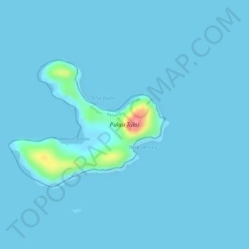
Name: Coral Island topographic map, elevation, terrain.
Location: Coral Island, Tioman, Rompin, Pahang, Malaysia (2.90591 104.09683 2.91980 104.11429)
Average elevation: 13 ft
Minimum elevation: 0 ft
Maximum elevation: 338 ft
Other topographic maps
Click on a map to view its topography, its elevation and its terrain.
Dragon's Horns (South Tower)
Dragon's Horns (South Tower), Tioman, Rompin, Pahang, Malaysia
Average elevation: 692 ft
Sungai Air Jerangau
Sungai Air Jerangau, Tioman, Rompin, Pahang, Malaysia
Average elevation: 315 ft