
Thank you for supporting this site ❤️
Make a donation
Make a donation
Gear up for your next adventure:
As an Amazon Associate, this site earns from qualifying purchases at no extra cost to you.
Bliesen topographic map
Click on the map to display elevation.
Thank you for supporting this site ❤️
Make a donation
Make a donation
Gear up for your next adventure:
As an Amazon Associate, this site earns from qualifying purchases at no extra cost to you.
About this map
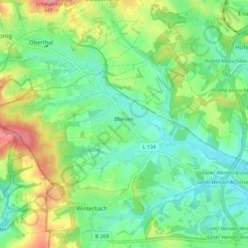
Name: Bliesen topographic map, elevation, terrain.
Location: Bliesen, Saint-Wendel, Landkreis St. Wendel, Sarre, Allemagne (49.47637 7.06774 49.51141 7.14917)
Average elevation: 1,073 ft
Minimum elevation: 919 ft
Maximum elevation: 1,398 ft
Thank you for supporting this site ❤️
Make a donation
Make a donation
Gear up for your next adventure:
As an Amazon Associate, this site earns from qualifying purchases at no extra cost to you.