
Fonseca topographic map
Interactive map
Click on the map to display elevation.
About this map
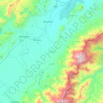
Name: Fonseca topographic map, elevation, terrain.
Location: Fonseca, La Guajira, Colombia (10.64793 -72.92156 11.03637 -72.67446)
Average elevation: 1,716 ft
Minimum elevation: 272 ft
Maximum elevation: 7,182 ft
Other topographic maps
Click on a map to view its topography, its elevation and its terrain.
Riohacha
Colombia > La Guajira > Riohacha
Riohacha, La Guajira, 44001, Colombia
Average elevation: 30 ft