
Thank you for supporting this site ❤️
Make a donation
Make a donation
Gear up for your next adventure:
As an Amazon Associate, this site earns from qualifying purchases at no extra cost to you.
Orane/Orani topographic map
Click on the map to display elevation.
Thank you for supporting this site ❤️
Make a donation
Make a donation
Gear up for your next adventure:
As an Amazon Associate, this site earns from qualifying purchases at no extra cost to you.
About this map
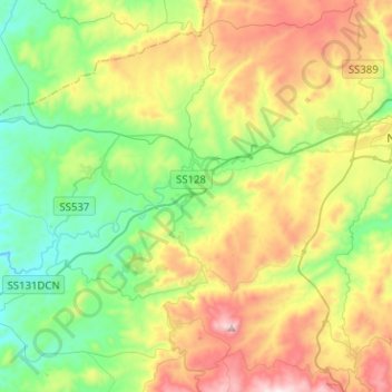
Name: Orane/Orani topographic map, elevation, terrain.
Location: Orane/Orani, Nuoro, Sardinia, 08026, Italy (40.21202 9.02626 40.37283 9.27901)
Average elevation: 1,670 ft
Minimum elevation: 584 ft
Maximum elevation: 3,517 ft
Thank you for supporting this site ❤️
Make a donation
Make a donation
Gear up for your next adventure:
As an Amazon Associate, this site earns from qualifying purchases at no extra cost to you.