Geolocate

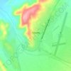
Geibigeb topographic map

Click on the map to display elevation.

About this map

Name: Geibigeb topographic map, elevation, terrain.

Location: Geibigeb, Kunene Region, Namibia (-20.73669 14.63572 -20.69669 14.67572)

Average elevation: 2,654 ft

Minimum elevation: 2,539 ft

Maximum elevation: 2,907 ft

Other topographic maps

Click on a map to view its topography, its elevation and its terrain.

Kamanjab

Namibia > Kunene Region

Average elevation: 3,993 ft

Opuwo

Namibia > Kunene Region

Average elevation: 3,789 ft

Namibe Desert

Namibia > Kunene Region

Average elevation: 909 ft

Outjo

Namibia > Kunene Region

Average elevation: 4,177 ft

Namibe Desert

Namibia > Kunene Region

Average elevation: 909 ft

Gear up for your next adventure:

🎒Day Hiking Backpack - Lightweight backpack perfect for day trips and outdoor adventures
📷Action Camera - Capture your outdoor adventures in HD
📖Nature Tracking Books - Learn to track wildlife and terrain
👖Convertible Hiking Pants - Versatile zip-off pants for changing altitudes and temperatures
🖼️Topo Map Wall Art - Decorative topographic prints of famous peaks and regions

As an Amazon Associate, this site earns from qualifying purchases at no extra cost to you.