Geolocate

Monte Cavo topographic map

Click on the map to display elevation.

About this map

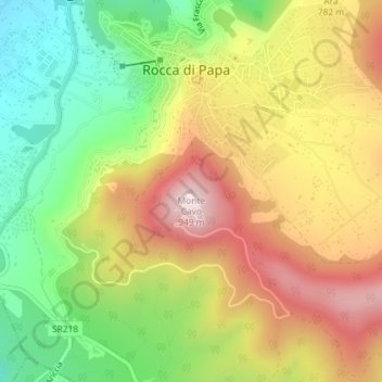
Name: Monte Cavo topographic map, elevation, terrain.

Location: Monte Cavo, Rocca di Papa, Roma Capitale, Lazio, 00074, Italy (41.75212 12.71004 41.75222 12.71014)

Average elevation: 2,293 ft

Minimum elevation: 1,519 ft

Maximum elevation: 3,120 ft

Gear up for your next adventure:

🧦Merino Wool Socks - Moisture-wicking, blister-preventing socks for long treks
🛡️Insect Repellent - Protection against bugs during outdoor activities
🌄Hiking Binoculars - Compact binoculars for scenic views and trail spotting
📶Vehicle Signal Boosters - Improve reception in rural areas while driving to trailheads
🥩Freeze-Dried Meals - Nutritious and lightweight food for remote expeditions

As an Amazon Associate, this site earns from qualifying purchases at no extra cost to you.