Geolocate

Beverley topographic map

Click on the map to display elevation.

About this map

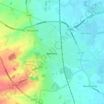
Name: Beverley topographic map, elevation, terrain.

Location: Beverley, East Riding of Yorkshire, England, United Kingdom (53.82721 -0.46888 53.85934 -0.38041)

Average elevation: 56 ft

Minimum elevation: -3 ft

Maximum elevation: 194 ft

Other topographic maps

Click on a map to view its topography, its elevation and its terrain.

Welton

United Kingdom > England > East Riding of Yorkshire

Average elevation: 128 ft

Gear up for your next adventure:

🖼️Topo Map Wall Art - Decorative topographic prints of famous peaks and regions
🩳Quick‑Dry Hiking Shorts - Comfortable and quick‑dry shorts for summer hiking
🔥Plasma Lighters - Windproof lighters that work in any weather condition
🧣Hiking Neck Gaiter - Multi‑use neck protection for outdoor weather
🌐World Map Poster - Decorative world maps with topographic info

As an Amazon Associate, this site earns from qualifying purchases at no extra cost to you.