
Thank you for supporting this site ❤️
Make a donation
Make a donation
Gear up for your next adventure:
As an Amazon Associate, this site earns from qualifying purchases at no extra cost to you.
Platoro topographic map
Click on the map to display elevation.
Thank you for supporting this site ❤️
Make a donation
Make a donation
Gear up for your next adventure:
As an Amazon Associate, this site earns from qualifying purchases at no extra cost to you.
About this map
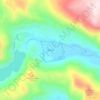
Name: Platoro topographic map, elevation, terrain.
Location: Platoro, Conejos County, Colorado, United States (37.33195 -106.55281 37.37195 -106.51281)
Average elevation: 10,518 ft
Minimum elevation: 9,793 ft
Maximum elevation: 11,824 ft
Thank you for supporting this site ❤️
Make a donation
Make a donation
Gear up for your next adventure:
As an Amazon Associate, this site earns from qualifying purchases at no extra cost to you.