Geolocate

Moressée topographic map

Click on the map to display elevation.

About this map

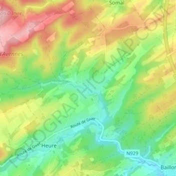
Name: Moressée topographic map, elevation, terrain.

Location: Moressée, Somme-Leuze, Dinant, Namur, Wallonie, 5377, Belgique (50.28769 5.28949 50.32769 5.32949)

Average elevation: 781 ft

Minimum elevation: 577 ft

Maximum elevation: 1,060 ft

Gear up for your next adventure:

🧦Merino Wool Socks - Moisture-wicking, blister-preventing socks for long treks
🪶LED Camping Lantern - Bright lantern for camp lighting
🖼️Topo Map Wall Art - Decorative topographic prints of famous peaks and regions
🦶Carbon Trekking Poles - Reduce knee impact on steep descents with ultra-light poles
🔦LED Headlamp - Bright and durable LED headlamp for night navigation

As an Amazon Associate, this site earns from qualifying purchases at no extra cost to you.