Geolocate

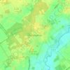
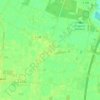
Kluse topographic map

Click on the map to display elevation.

About this map

Name: Kluse topographic map, elevation, terrain.

Location: Kluse, Samtgemeinde Dörpen, Landkreis Emsland, Nedersaksen, Duitsland (52.90713 7.28990 52.95749 7.39972)

Average elevation: 30 ft

Minimum elevation: 3 ft

Maximum elevation: 72 ft

Other topographic maps

Click on a map to view its topography, its elevation and its terrain.
Sustrum-Moor

Duitsland > Nedersaksen > Landkreis Emsland

Average elevation: 36 ft

Gleesen

Duitsland > Nedersaksen > Landkreis Emsland

Average elevation: 95 ft

Neusustrum

Duitsland > Nedersaksen > Landkreis Emsland

Average elevation: 36 ft

Hesselte

Duitsland > Nedersaksen > Landkreis Emsland > Emsbüren

Average elevation: 102 ft

Baccum

Duitsland > Nedersaksen > Landkreis Emsland > Lingen (Ems)

Average elevation: 138 ft

Ramsel

Duitsland > Nedersaksen > Landkreis Emsland > Lingen (Ems)

Average elevation: 128 ft

Sprakel

Duitsland > Nedersaksen > Landkreis Emsland > Stavern

Average elevation: 128 ft

Sand

Duitsland > Nedersaksen > Landkreis Emsland > Oberlangen

Average elevation: 33 ft

Haar

Duitsland > Nedersaksen > Landkreis Emsland > Haren (Ems)

Average elevation: 49 ft

Gear up for your next adventure:

📡Handheld GPS Device - Reliable handheld GPS for outdoor navigation
🔋Solar Power Banks - Keep your GPS and phone charged in remote wilderness areas
😴Insulated Sleeping Pads - Compact and warm pads for high-elevation camping
🧺Microfiber Travel Towels - Compact and fast-drying towels for trail use
🦟Ultrasonic Repellers - Create a bug-free zone at your camp or rest stop

As an Amazon Associate, this site earns from qualifying purchases at no extra cost to you.