
Thank you for supporting this site ❤️
Make a donation
Make a donation
Gear up for your next adventure:
As an Amazon Associate, this site earns from qualifying purchases at no extra cost to you.
Goingarijp topographic map
Click on the map to display elevation.
Thank you for supporting this site ❤️
Make a donation
Make a donation
Gear up for your next adventure:
As an Amazon Associate, this site earns from qualifying purchases at no extra cost to you.
About this map
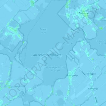
Name: Goingarijp topographic map, elevation, terrain.
Location: Goingarijp, De Fryske Marren, Friesland, Nederland (52.99623 5.73324 53.04684 5.78221)
Average elevation: -3 ft
Minimum elevation: -23 ft
Maximum elevation: 20 ft
Thank you for supporting this site ❤️
Make a donation
Make a donation
Gear up for your next adventure:
As an Amazon Associate, this site earns from qualifying purchases at no extra cost to you.