
Korgalzhyn District topographic map
Interactive map
Click on the map to display elevation.
About this map
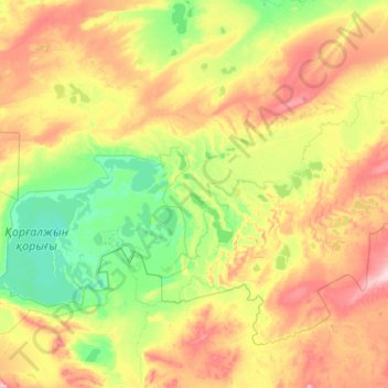
Name: Korgalzhyn District topographic map, elevation, terrain.
Location: Korgalzhyn District, Akmola Region, Kazakhstan (50.03919 68.67393 51.11492 70.85371)
Average elevation: 1,135 ft
Minimum elevation: 984 ft
Maximum elevation: 1,519 ft
Other topographic maps
Click on a map to view its topography, its elevation and its terrain.
Astrakhan District
Astrakhan District, Akmola Region, Kazakhstan
Average elevation: 1,060 ft
Kokshetau
Kazakhstan > Akmola Region > Кокшетау Г.А. > Kokshetau
Kokshetau, Кокшетау Г.А., Akmola Region, 020000, Kazakhstan
Average elevation: 820 ft
Lake Tengiz
Lake Tengiz, Коргалжынский район, Akmola Region, Kazakhstan
Average elevation: 1,043 ft