Geolocate

El Refugio topographic map

Click on the map to display elevation.

About this map

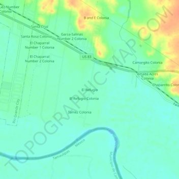
Name: El Refugio topographic map, elevation, terrain.

Location: El Refugio, Starr County, Texas, 78547, United States (26.32035 -98.77586 26.36035 -98.73586)

Average elevation: 164 ft

Minimum elevation: 125 ft

Maximum elevation: 253 ft

Starr County trails, hiking, mountain biking, running and outdoor activities

Gear up for your next adventure:

🧥Waterproof Jacket for Hiking - Breathable and rugged rain jacket for outdoor excursions
🛏️Cold Weather Sleeping Bag - Warm sleeping bag for cold conditions
🪶Fire Starter Kit - Reliable fire starter for survival and camping
🕶️Glacier Sunglasses - Side shields to protect eyes from high-altitude snow glare
🧯Emergency Survival Kit - All‑in‑one survival essentials for the backcountry

As an Amazon Associate, this site earns from qualifying purchases at no extra cost to you.