Geolocate

Valley Falls topographic map

Click on the map to display elevation.

About this map

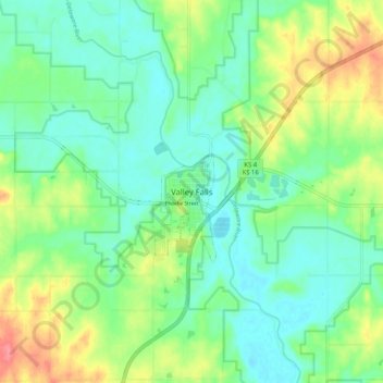
Name: Valley Falls topographic map, elevation, terrain.

Location: Valley Falls, Jefferson County, Kansas, 66088, United States (39.30323 -95.49973 39.38323 -95.41973)

Average elevation: 971 ft

Minimum elevation: 896 ft

Maximum elevation: 1,122 ft

Jefferson County trails, hiking, mountain biking, running and outdoor activities

Gear up for your next adventure:

📚USA Hiking Guide Books - Top trail guides and map books
🗺️Topographic Maps - Detailed topo maps for hiking, exploring and outdoor navigation
🚗GPS Dash Cams - Record your scenic drives through mountain passes and canyons
🧭Orienteering Set - Complete compass and map reading kit
🧴Hand Sanitizer - Keep hands clean while hiking

As an Amazon Associate, this site earns from qualifying purchases at no extra cost to you.