
Thank you for supporting this site ❤️
Make a donation
Make a donation
Gear up for your next adventure:
As an Amazon Associate, this site earns from qualifying purchases at no extra cost to you.
Rakvere topographic map
Click on the map to display elevation.
Thank you for supporting this site ❤️
Make a donation
Make a donation
Gear up for your next adventure:
As an Amazon Associate, this site earns from qualifying purchases at no extra cost to you.
About this map
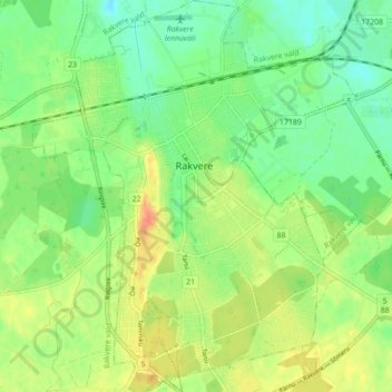
Name: Rakvere topographic map, elevation, terrain.
Location: Rakvere, Rakvere linn, Lääne-Viru maakond, Estonia (59.32249 26.32563 59.36701 26.39751)
Average elevation: 266 ft
Minimum elevation: 207 ft
Maximum elevation: 338 ft
Thank you for supporting this site ❤️
Make a donation
Make a donation
Gear up for your next adventure:
As an Amazon Associate, this site earns from qualifying purchases at no extra cost to you.