Geolocate

Lancaster topographic map

Click on the map to display elevation.

About this map

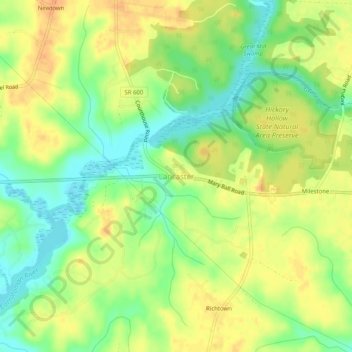
Name: Lancaster topographic map, elevation, terrain.

Location: Lancaster, Lancaster County, Virginia, 22513, United States (37.74986 -76.48634 37.78986 -76.44634)

Average elevation: 66 ft

Minimum elevation: 0 ft

Maximum elevation: 118 ft

Lancaster County trails, hiking, mountain biking, running and outdoor activities

Gear up for your next adventure:

📖Nature Tracking Books - Learn to track wildlife and terrain
🦶Carbon Trekking Poles - Reduce knee impact on steep descents with ultra-light poles
🥄Camping Utensil Set - Lightweight utensils for outdoor meals
📚Navigation Handbooks - Master the art of reading topographic maps and using a compass
🩹Survival Bandages - High‑quality bandages for emergencies

As an Amazon Associate, this site earns from qualifying purchases at no extra cost to you.