
Thank you for supporting this site ❤️
Make a donation
Make a donation
Gear up for your next adventure:
As an Amazon Associate, this site earns from qualifying purchases at no extra cost to you.
Ouacif topographic map
Click on the map to display elevation.
Thank you for supporting this site ❤️
Make a donation
Make a donation
Gear up for your next adventure:
As an Amazon Associate, this site earns from qualifying purchases at no extra cost to you.
About this map
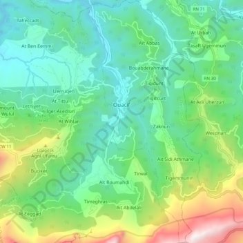
Name: Ouacif topographic map, elevation, terrain.
Location: Ouacif, Ouacif District, Tizi Ouzou, 15015, Algeria (36.47929 4.19152 36.55739 4.23717)
Average elevation: 2,277 ft
Minimum elevation: 846 ft
Maximum elevation: 6,086 ft
Thank you for supporting this site ❤️
Make a donation
Make a donation
Gear up for your next adventure:
As an Amazon Associate, this site earns from qualifying purchases at no extra cost to you.