
Thank you for supporting this site ❤️
Make a donation
Make a donation
Gear up for your next adventure:
As an Amazon Associate, this site earns from qualifying purchases at no extra cost to you.
Goj topographic map
Click on the map to display elevation.
Thank you for supporting this site ❤️
Make a donation
Make a donation
Gear up for your next adventure:
As an Amazon Associate, this site earns from qualifying purchases at no extra cost to you.
About this map
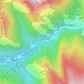
Name: Goj topographic map, elevation, terrain.
Location: Goj, Manikaran, Kullu, Himachal Pradesh, 175105, India (31.99908 77.31174 32.03908 77.35174)
Average elevation: 7,139 ft
Minimum elevation: 5,026 ft
Maximum elevation: 10,341 ft
Thank you for supporting this site ❤️
Make a donation
Make a donation
Gear up for your next adventure:
As an Amazon Associate, this site earns from qualifying purchases at no extra cost to you.