
Thank you for supporting this site ❤️
Make a donation
Make a donation
Gear up for your next adventure:
As an Amazon Associate, this site earns from qualifying purchases at no extra cost to you.
Gratallops topographic map
Click on the map to display elevation.
Thank you for supporting this site ❤️
Make a donation
Make a donation
Gear up for your next adventure:
As an Amazon Associate, this site earns from qualifying purchases at no extra cost to you.
About this map
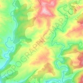
Name: Gratallops topographic map, elevation, terrain.
Location: Gratallops, Priorat, Tarragona, Catalonia, 43737, Spain (41.17340 0.75719 41.21340 0.79719)
Average elevation: 837 ft
Minimum elevation: 354 ft
Maximum elevation: 1,424 ft
Thank you for supporting this site ❤️
Make a donation
Make a donation
Gear up for your next adventure:
As an Amazon Associate, this site earns from qualifying purchases at no extra cost to you.