
Sedona topographic map
Click on the map to display elevation.
About this map
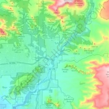
Name: Sedona topographic map, elevation, terrain.
Location: Sedona, Coconino County, Arizona, 86339, United States (34.82967 -111.80116 34.90967 -111.72116)
Average elevation: 4,836 ft
Minimum elevation: 3,990 ft
Maximum elevation: 6,965 ft
Arizona trails, hiking, mountain biking, running and outdoor activities