
Kitigan topographic map
Interactive map
Click on the map to display elevation.
About this map
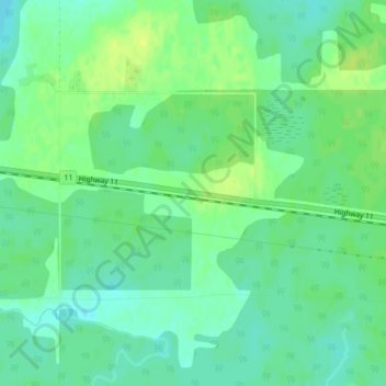
Name: Kitigan topographic map, elevation, terrain.
Average elevation: 768 ft
Minimum elevation: 741 ft
Maximum elevation: 797 ft
Other topographic maps
Click on a map to view its topography, its elevation and its terrain.
Ranoke
Canada > Ontario > Unorganized North Cochrane
Ranoke, Unorganized North Cochrane, Cochrane District, Ontario, Canada
Average elevation: 226 ft
Lake Abitibi
Canada > Ontario > Unorganized North Cochrane
Lake Abitibi, Unorganized North Cochrane, Cochrane District, Ontario, Canada
Average elevation: 958 ft
Harker Lake
Canada > Ontario > Unorganized North Cochrane
Harker Lake, Unorganized North Cochrane, Cochrane District, Ontario, Canada
Average elevation: 1,010 ft
Crawfish Lake
Canada > Ontario > Unorganized North Cochrane
Crawfish Lake, Connaught Evelyn Road, Unorganized North Cochrane, Cochrane District, Ontario, Canada
Average elevation: 925 ft