
Make a donation
Gear up for your next adventure:
As an Amazon Associate, this site earns from qualifying purchases at no extra cost to you.
Burao topographic map
Click on the map to display elevation.
Make a donation
Gear up for your next adventure:
As an Amazon Associate, this site earns from qualifying purchases at no extra cost to you.
Burao
Weather in Burao, much like other inland towns in Somaliland, is very warm to hot and dry year-round. The city has a hot arid climate (Köppen BWh) in common with most of Somalia, although Burao's weather is moderated by altitude. The average daytime temperatures during the summer months of June and August can rise to 31 °C or 87.8 °F, with a low of 20 °C or 68 °F at night. The weather is cooler the rest of the year, averaging 27 °C or 80.6 °F during the day and 13 °C or 55.4 °F at nighttime. The city's limited rainfall of 222 millimetres or 9 inches usually comes with two peaks during April–May and October–November.
Make a donation
Gear up for your next adventure:
As an Amazon Associate, this site earns from qualifying purchases at no extra cost to you.
About this map
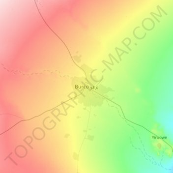
Name: Burao topographic map, elevation, terrain.
Location: Burao, Burao District, Togdheer, Somaliland, Somalia (9.36776 45.37811 9.68776 45.69811)
Average elevation: 3,448 ft
Minimum elevation: 3,100 ft
Maximum elevation: 3,842 ft
Make a donation
Gear up for your next adventure:
As an Amazon Associate, this site earns from qualifying purchases at no extra cost to you.