
Thank you for supporting this site ❤️
Make a donation
Make a donation
Gear up for your next adventure:
As an Amazon Associate, this site earns from qualifying purchases at no extra cost to you.
Gaiano topographic map
Click on the map to display elevation.
Thank you for supporting this site ❤️
Make a donation
Make a donation
Gear up for your next adventure:
As an Amazon Associate, this site earns from qualifying purchases at no extra cost to you.
About this map
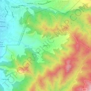
Name: Gaiano topographic map, elevation, terrain.
Location: Gaiano, Fisciano, Salerno, Campania, 84080, Italia (40.73585 14.79688 40.77585 14.83688)
Average elevation: 1,624 ft
Minimum elevation: 761 ft
Maximum elevation: 2,864 ft
Thank you for supporting this site ❤️
Make a donation
Make a donation
Gear up for your next adventure:
As an Amazon Associate, this site earns from qualifying purchases at no extra cost to you.