
Tunis Tourist village topographic map
Interactive map
Click on the map to display elevation.
About this map
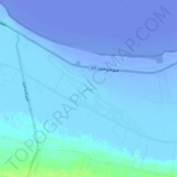
Name: Tunis Tourist village topographic map, elevation, terrain.
Location: Tunis Tourist village, Faiyum, Egypt (29.37830 30.47243 29.41830 30.51243)
Average elevation: -69 ft
Minimum elevation: -157 ft
Maximum elevation: 39 ft
Other topographic maps
Click on a map to view its topography, its elevation and its terrain.
Magic Lake from Mt Medawara
Egypt > Faiyum > Izbat al Khamsin
Magic Lake from Mt Medawara, Wadi Al Rayan Road, Izbat al Khamsin, Faiyum, 63626, Egypt
Average elevation: -33 ft
Youssef Al Sediq City
Youssef Al Sediq City, Faiyum, 63626, Egypt
Average elevation: 23 ft
Hatem Et Taei
Egypt > Faiyum > Youssef Al Sediq City
Hatem Et Taei, Youssef Al Sediq City, Faiyum, 63626, Egypt
Average elevation: 115 ft