
Thank you for supporting this site ❤️
Make a donation
Make a donation
Gear up for your next adventure:
As an Amazon Associate, this site earns from qualifying purchases at no extra cost to you.
Zhob river topographic map
Click on the map to display elevation.
Thank you for supporting this site ❤️
Make a donation
Make a donation
Gear up for your next adventure:
As an Amazon Associate, this site earns from qualifying purchases at no extra cost to you.
About this map
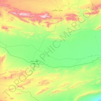
Name: Zhob river topographic map, elevation, terrain.
Location: Zhob river, Qila Saifullāh District, Balochistan, Pakistan (30.71483 68.09978 30.83636 68.84845)
Average elevation: 5,807 ft
Minimum elevation: 4,291 ft
Maximum elevation: 9,403 ft
Thank you for supporting this site ❤️
Make a donation
Make a donation
Gear up for your next adventure:
As an Amazon Associate, this site earns from qualifying purchases at no extra cost to you.